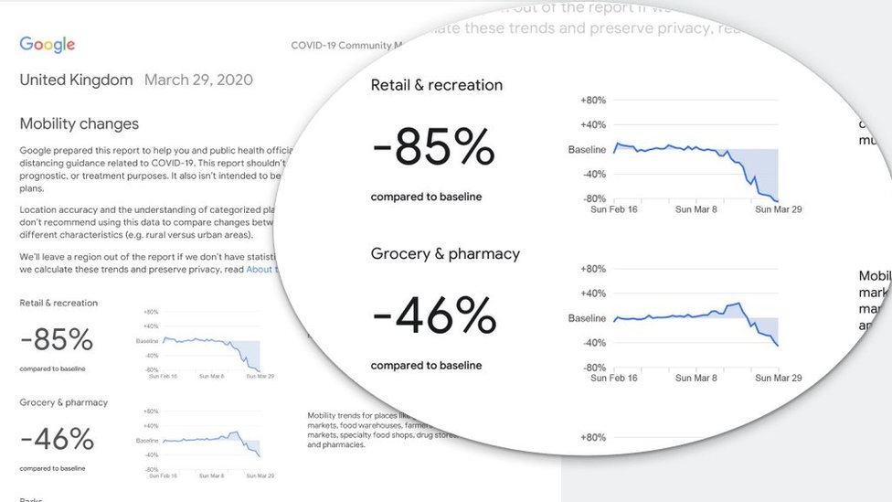
Google is to publicly track people’s movements over the course of the coronavirus pandemic.
The tech firm will publish details of the different types of places people are going to on a county-by-county basis in the UK, as well as similar data for 130 other countries.
The plan is to issue a regular updates with the figures referring back to activity from two or three days prior.
The company has promised that individuals’ privacy will be preserved.
The readings are based on location data gathered via the Google Maps app or one of the firm’s other mobile services.
The firm typically uses this to reveal when specific museums, shops and other places are busiest as well as to revise driving routes to help motorists avoid traffic.

In this case, the readings will be broken down to reveal how busy the following types of places are compared to a period earlier in the year before lockdowns were introduced:
- retail and recreation
- grocery and pharmacy
- parks, beaches and plazas
- bus, subway and train stations
- office buildings and other places of work
- residential
Google said it hoped the information could be used by public health chiefs and others to help manage the outbreak.
“This information could help officials understand changes in essential trips that can shape recommendations on business hours or inform delivery service offerings,” it blogged.
“Similarly, persistent visits to transportation hubs might indicate the need to add additional buses or trains in order to allow people… room to spread out for social distancing.”


